 Source: North American Population Density Map, Paul Roebuck, Ph.D
Remember the water fountain and the faucet that you use every day? Would you move to an area where there was no access to water? Now that you have learned about the different types of surface waters, you will learn how surface waters affect where people live. Take a look at each of the following maps.
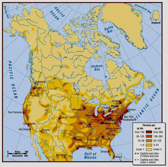
North American - Population Density
Source: North American Population Density Map, Paul Roebuck, Ph.D
Population density refers to the areas where there are more people who live in a particular area compared to other areas. Examine this map closely and determine the patterns of human settlement (where people live) in North America. Where do most people live? What do these areas have in common? Where do the least amount of people live? What do these areas have in common?
Global Lakes and Wetlands - 2004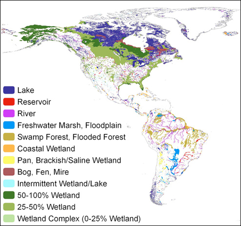 Source:Global Lakes and Wetlands Database-(Lehner & Doll 2004), Geoserver.
This map illustrates the location of various types of surface water globally. Examine this map and see if you recognize any trends. Now compare this map to the population density map. You will need both of these maps to complete the activity.
In your notes, complete the following activity: