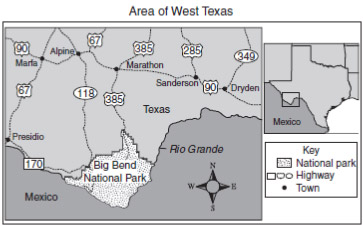
Source: Area of West Texas, Released Exit level TAKS Social Studies April 2009, Texas Education Agency
Prior to the invention of the locomotive (train) and the automobile, people primarily traveled by ship across waterways. Therefore, it was very important to build your city along a river or coastline, not only for easier farming, but also for easy access to trade routes. However, once cars and trains became common, travel across mountains, deserts, and other less hospitable areas became much more accessible.
Source: Area of West Texas, Released Exit level TAKS Social Studies April 2009, Texas Education Agency
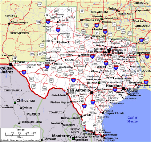
Source: Texas State Map, Top 50 States
Looking at the inset map above, you will notice that major cities have developed along the junction of two or more highways. In fact, you will notice that none of these towns are situated along a major river at all. While water is still important for survival, it became less important for travel allowing settlers to have more choices for urbanization.
As urbanization increased, manmade features such as highways, bridges, and railroads were created to facilitate transportation and movement of goods and ideas between cities and outlying areas. Manmade features are important to locations where natural features and resources are limited.
Visit this link and click on “Map” to make the manmade features such as highways visible. (Click labels and photos for more information to be displayed).
Add this to your notes for use in your Letter to the Editor: