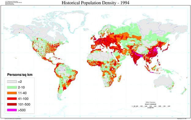
Source: Map, Human Population Density-1994, U.S. Department of Agriculture
 Source: Map, Human Population Density-1994, U.S. Department of Agriculture
Source: Map, Human Population Density-1994, U.S. Department of Agriculture
Source: Map, Human Population Density-1994, U.S. Department of Agriculture