Source: British Indian Empire 1909 Imperial Gazetteer of India, Wikipedia
In the mid-1700s the British began to use trade and commerce to slowly take power over various regions of India. In 1847, a revolt against the powerful British East India Trading Company began. As a result of the rebellion, the British Empire took complete control over the areas considered India at that time.
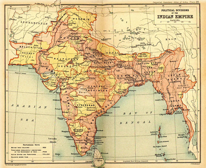
This map shows the area considered British India as of 1909.
Source: British Indian Empire 1909 Imperial Gazetteer of India, Wikipedia
For nearly 100 years the British ruled India and made great profits off the spices and cotton grown there. The people of this vast region eventually organized to promote self-rule. The Indian National Congress and the Muslim League worked for years to convince the British government to leave so the nation could be independent.
In 1947 India became independent. The issue of independent rule was not an easy one to solve. At this point the people were used to a European style form of government. Conflict grew over representation in the new government. The people of the Hindu faith were the majority and felt they should be the majority in the new government. The people of Islamic faith felt that as a minority of the population and a minority in government, their interests would not be represented.
Violence often broke out between the two frustrated groups and a decision was finally made to partition India into three separate countries. India would have a majority Hindu government, while Pakistan and Bangladesh would have Muslim governments. Click on the map to locate the new countries.

Source: British Indian Empire 1909 Imperial Gazetteer of India, Wikipedia
Once the nations were separated mass migrations of people began. Hindus from the regions that were now considered Pakistan and Bangladesh began to migrate into Hindu ruled India. Muslims in India began to migrate into Pakistan and Bangladesh.
An estimated 12.5 million people left homes, land, and lives behind with only what they could carry to make the journey. Many people traveled on foot and many people did not survive the trip. Each group blamed the hardships of migration on the other, furthering the tension and conflict between Hindus and Muslims in the region.
Take a look at the photo gallery that chronicles the mass migration in India at the link below:
Choose one of the photos from the gallery and answer the following questions in your notes.
Modified from: Photo analysis worksheet, National Archives