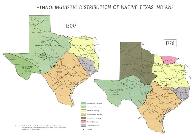
Source: Enthnolingustic Native Map, National Park Service
Now let's analyze an example that is closer to home. In this section, you will analyze a series of maps that illustrate the change in the boundaries in the state of Texas. Learn what factors influenced these changes over time. Use this information in addition to what you have learned to complete the activities that follow.
The State of Texas has been in its current shape since the year 1850. Before it joined the United States, it took many forms depending on how different people used it.
Source: Enthnolingustic Native Map, National Park Service
Prehistoric Texas is the land before the arrival of Europeans in the 15th-16th Centuries. Texas was then occupied by Native American tribes. Some nomadic, others local. These groups tended to define possession by land usage. There was no clear border in the European sense. Many times territories overlapped as some of the Native American tribes were nomadic.
Spanish Possessions, Mexico and Florida, 1725
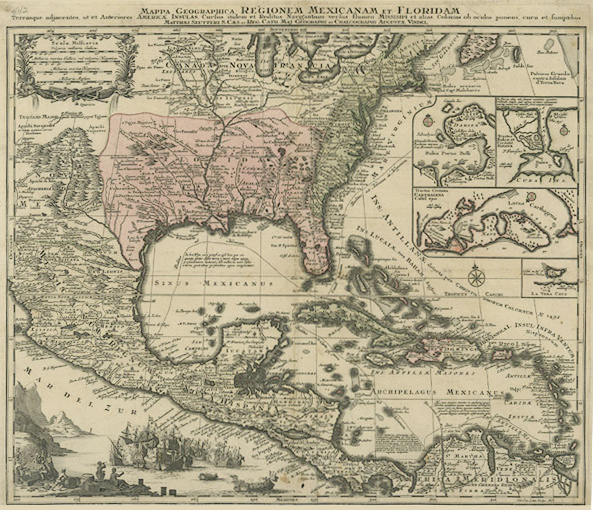
Source: Mappa Geographica Regionem Mexicanam, Texas General Land Office
This map shows Spanish possession in 1725. Note that the Spanish had not explored the full extent of what they claimed so you don't see California on this map and there is no border to distinguish Texas from any other piece of land.
Which of the following natural features might early leaders have used to separate Texas from other places?
| Rivers | Interactive popup. Assistance may be required. Absolutely! The Red, Sabine, and Rio Grande were considered boundaries of the territory.Close |
| Mountains | Interactive popup. Assistance may be required. Definitely! The Mountains of West Texas made a distinct boundary for the territory. Close |
| Oceans | Interactive popup. Assistance may be required. Yes! The Gulf of Mexico was a formidable natural boundary in the Eastern part of Texas. Close |
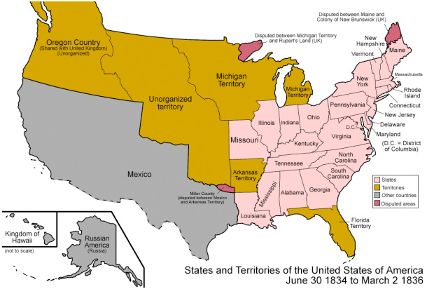
Source: States and Territories of the United States of America (June 30, 1834 to March 2, 1836), La Chuleta Congela, Wordpress
Once people of European origin took possession, lines of ownership began to be implemented. At this point in history, people in the United States were already moving west in search of new land and opportunities for economic success. This included immigration into the Mexican territory.
The borders separating Mexico and the United States on its Eastern border are the Sabine and Red Rivers. Here, geography has created a natural and political border between two people. This would change once the population of Anglo-Europeans became significantly higher than the Hispanic population of the Mexican territory.
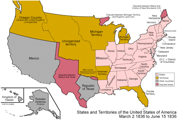
Source: States and Territories of the United States of America (June 30, 1834 to March 2, 1836), La Chuleta Congela, Wordpress
In 1836, the Anglo-Americans in the Texas territory rebelled and fought a war for independence. After the war ended, the two nations disagreed as to the western political boundary of the new Republic of Texas. The Texans claimed the land all the way to the headwaters of the Colorado River. During the Republic of Texas years, (1836-1845) the Texans and New Mexicans argued over the western territorial claims. This explains the dark pink area on the map above.

Once Texas became an independent country (also called a republic), it attempted to define its borders and became much larger than it is today. Through conflict with people occupying the western border, constant border skirmishes with Mexico, and annexation to the United States, Texas would take on its current political boundaries. In this map, we also see a major piece of land sold to the United States, following the Mexican War. This would lead to new compromises and the decrease in Texas' size.
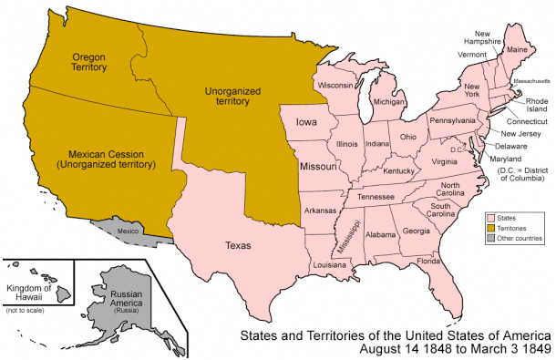
Source: States and Territories of the United States of America (August 14, 1848 to March 3, 1849), La Chuleta Congela, Wordpress
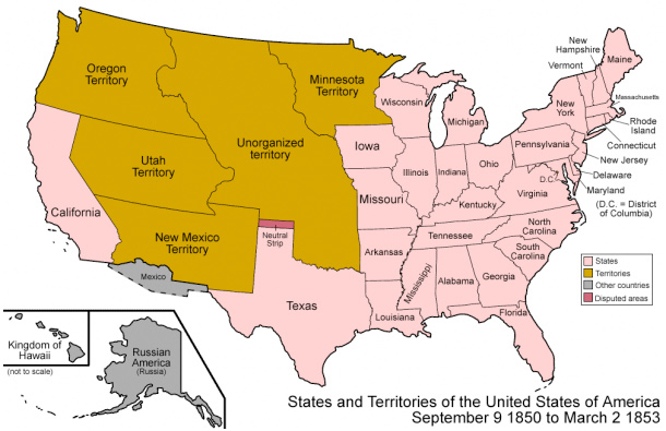
Source: States and Territories of the United States of America (September 9, 1850 to March 2, 1853), La Chuleta Congela, Wordpress
In your notes, answer the following questions.